
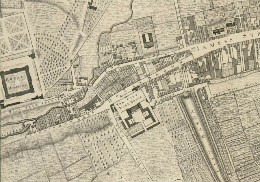
Here’s another detail from that extraordinary treasure trove and endless mine of information that is John Roque’s 1756 map of Dublin.
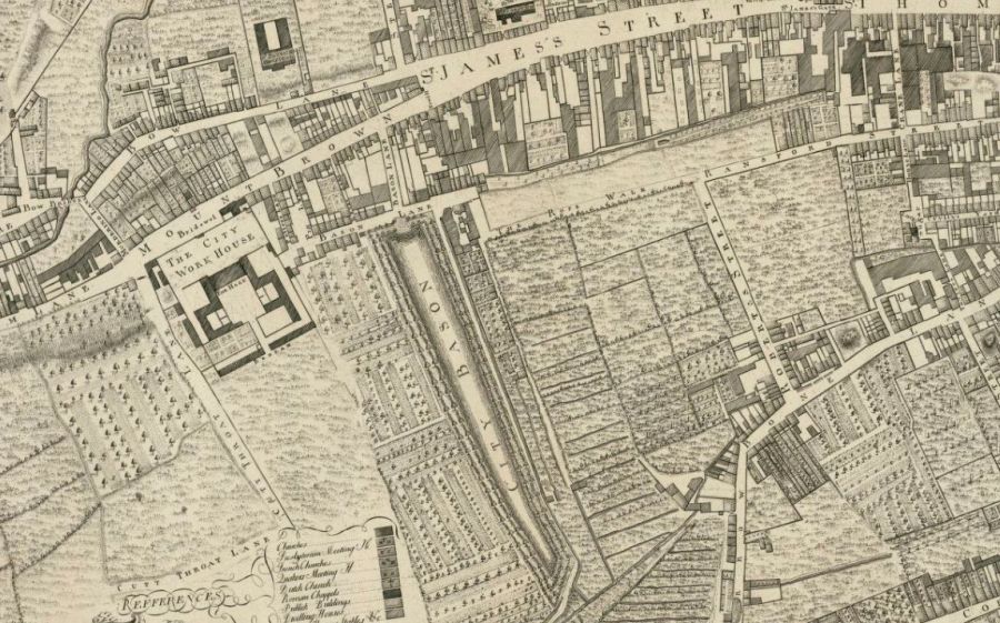
This particular detail shows the location of the old city basin relative to nearby streets and buildings.
The city basin has now been filed in of course. It sat or lay just west of where the huge Guinness Storehouse is now, between it and Saint James Hospital, (more of which anon)
Of course Roque has spelt the Basin “Bason” (He was first-generation French Huguenot and anyway, spelling was fairly arbitrary in the 18th century)
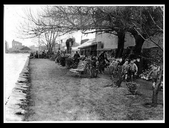
I’m very grateful to a recent guest on one of our walking tours, Pauline, for sending me via our Dublin Decoded Facebook page, this terrific old photo, showing of the edge of the canal basin, as it lay just outside a convent there.
and here below is another image, below, also provided by Pauline, showing another section of the canal, the Canal Basin or terminus area, seen from above.
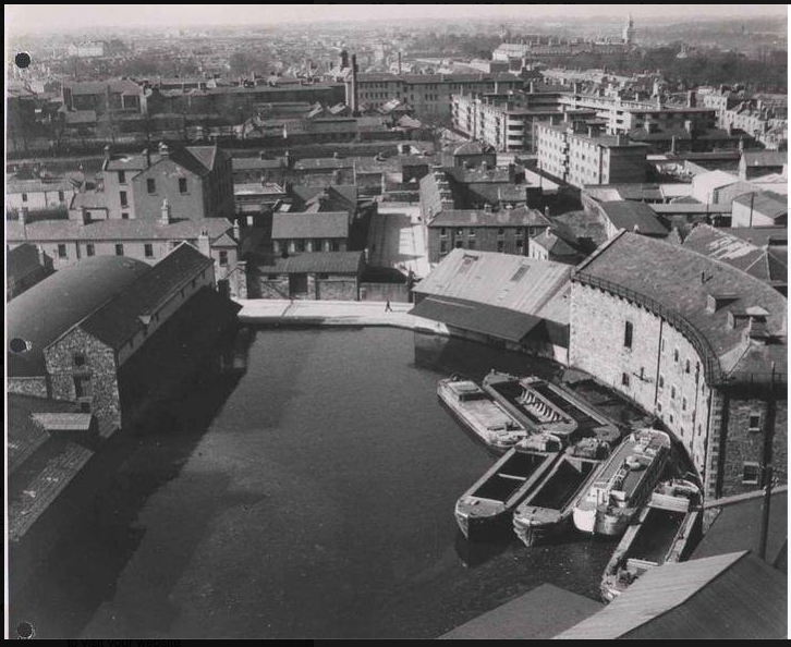
This of course is at the very end of the canal, the basin itself, as it met those curved buildings. These buildings with their distinctive curve are still there of course. On their other side, they face Echlin St, which in turn runs North to James St. The Canal basin is not to be confused with the City Basin, which was a drinking water water supply. That lay just to the west, as you can see in Rocque’s map at the top of this page. The city basin predated the Canal.
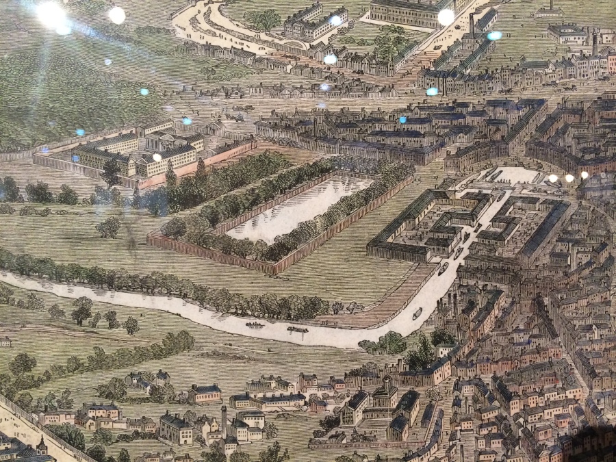
You can see both canal harbour and city basin (the reservoir) in this detail below, from this wonderful 19th century engraving. (I don’t currently know the artist, but would be glad to learn & acknowledge it) Here we can see not just the City basin, but also the distinctively shaped harbour of the Grand Canal nearby. This harbour was the original terminus of the Grand canal, until the main line canal-proper was extended further east to around Pearse Street bridge. This was of course to be closer to the ports and docks. But this section of grand canal remained behind, providing both water to make untold pints of the black stuff, as well as vital transport for the finished product.
Roque’s map really is the most amazing resource. Taking another, much closer look at it, we can pick out other notable local buildings, including St James church. Since this map dates from 1756, there is only a C.of Ireland (Anglican) church here. You’ll spot it top right of map. Later, by the early to mid 19th century there were two St James churches, one RC (south of the road) and the other CoI (Anglican) north of the road. As Anglican congregations dwindled, the C.oI. version later became a lighting shop, and is now I believe, a whiskey museum.
Needless to say, St James’ church is synonymous as the departure point for medieval and later pilgrims to begin the trail, or Camino, to Santiago de Compostella, that famed city in northern Spain housing the relics and shrine of St James himself. This is where one began, or indeed begin your long journey, and get the first stamp on your pilgrims passport.
To the left (west) of our map is the Royal Hospital at Kilmanham, a home for retired and injured soldiers, with its distinctive quadrangle, modeled everyone says on Les Invailides in Paris, and the even more distinctive shape of its formal classical gardens, which have been brilliantly restored in the last 25 years. As all Dublin readers know, the buildings itself, which boast a spectacular Rococo chapel, is also the home to the Irish Museum of Modern Art, IMMA.

What else can we see? Well, if we come back to the centre of the first detail, you’ll see how the former, much hated Work House, lay just SW of the basin.
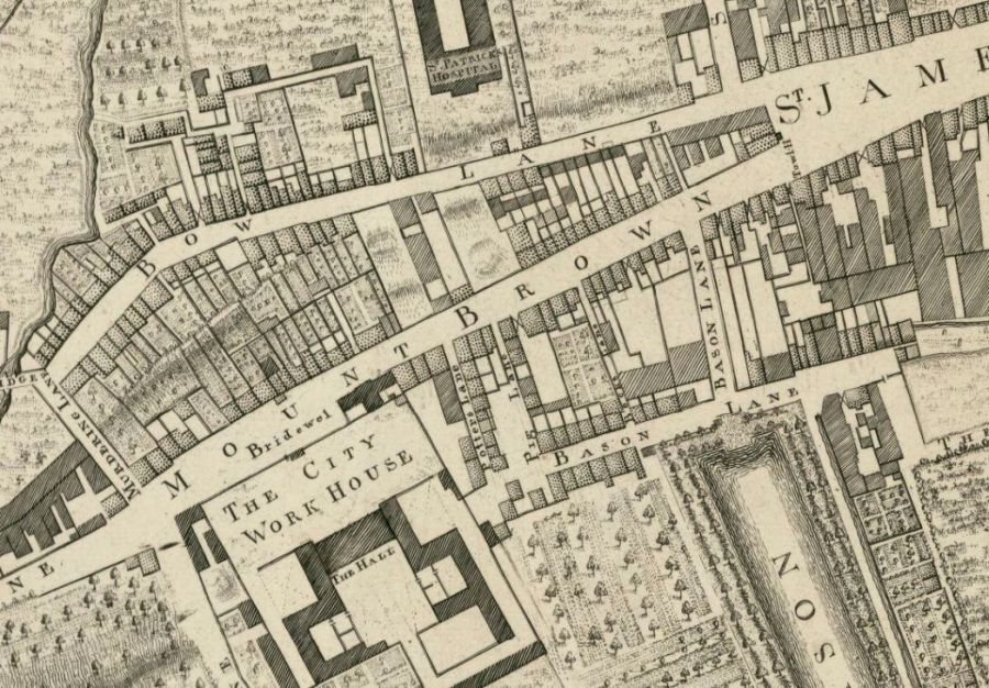
In the 19th and into the early 20th century, the hated work house was also known as the South Dublin Union. As it commanded the western approaches to the city it was occupied by the 1916 rebels. Some of the fiercest fighting anywhere in the city 1916 took place here, with an injured Cathal Brugha using his body to block out British troops from forcing open a door. This site is now now the site of James’ Hospital.
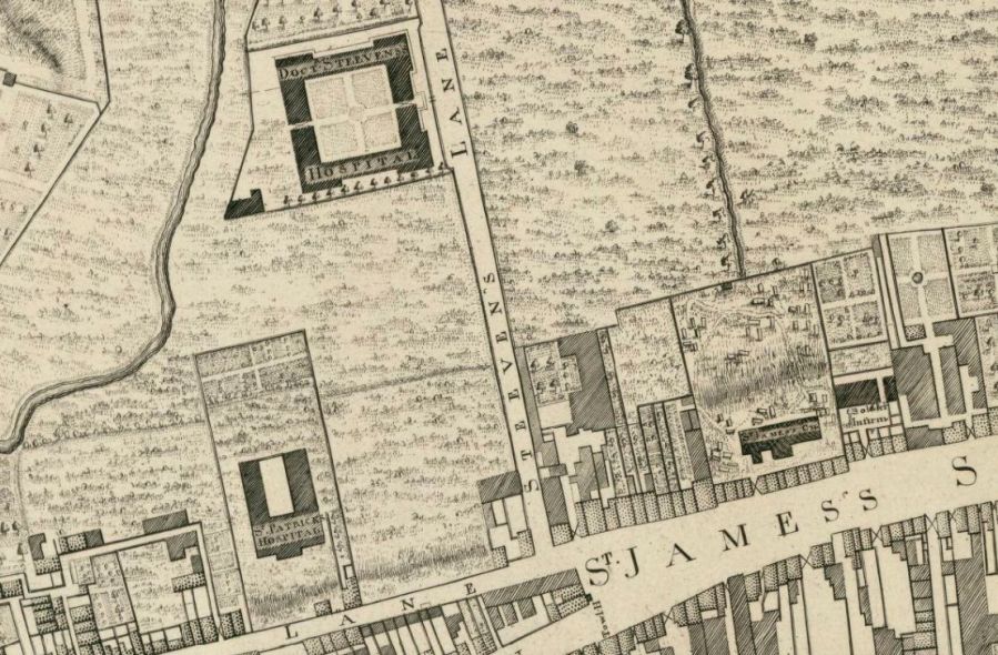
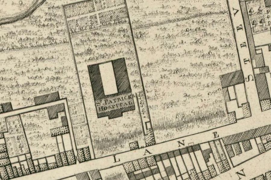
Going North from this point are two more historic hospitals. Lying behind its high walls off Bow Lane is St Patrick’s Mental hospital (SPMH) an early 18th century home for people with psychiatric issues, founded virtue of an endowment by the great Dean Jonathan Swift. It has done much superb and vital work in its over 250 year existence.
Beyond that, north again, is another wonderful former hospital, Dr Stevens’ Hospital, which is home to the amazing Worth Library.
But I think we’ll end our little exploring trip those famous, pithy, tart little lines of verse by Dean Swift, musing on his founding endowment that made possible St Patrick’s Hospital … He doesn’t sound like a man who is driven by pathos and comapssion, yet everything we know about tells us that’s exactly what he was. Anyway, here is the great man, musing on his gift.
“He gave the little wealth he had /
to found a house for fools and mad /
and proved with one satyric touch /
No nation wanted it so much.”
It sounds like cold and scathing stuff. Yet it issued from a complex, but endlessly compassionate soul. It is in the nature of genius to be contradictory perhaps. That was certainly the case with Swift.
If you’d like to see other parts of the map, and/or link to other historic maps of Dublin, or subscribe to the free newsletter for our sociable history walks of Dublin, all of that and more can be found at the foot of this article.

I enjoyed this one Arran, particularly the photo of the basin before it was fill in. Emmeline
LikeLiked by 1 person
Thank you Emmeline, very glad you enjoyed this. Agree its a super photo, was delighted to receive it from Pauline. Many thanks to her again!
LikeLike
I really enjoyed finding this article particularly as I live close to that part of historic Dublin,close to the law library.I have always loved old maps and to have them explained so well was a joy.the Royal hospital in kilmainham is a favourite haunt of mine and I found that article most interesting.thanks so much 🙂
LikeLike
my absolute pleasure Mary. and thank you for such a kind and gracious response. Makes it all worthwhile, getting a lovely comment like that!
LikeLike
Many thanks Arran for all your interesting posts. Here’s some info on what the City Basin, and the various additions from the Grand Canal, looked like.
http://irishwaterwayshistory.com/abandoned-or-little-used-irish-waterways/waterways-in-dublin/the-abandoned-main-line-of-the-grand-canal-2/
LikeLike
You’re very kind Patrick, very glad you enjoy them, and thank you for taking the time to say so. Thanks also for your link to that 3-part piece on the abandoned section of the Grand Canal and its harbour. I remember coming across that website last year, when i was doing some research on the area, it is very well written and put together. I’ve no doubt it’ll be of great interest to my readers here. Thank you.
-Arran.
LikeLike